Translated from Marathi, कठीण (Kathin), means difficult. So what do you do when you have a few nights at Arowana Dew Luxury Villa in Lonavala? You drive 14 minutes to the base of “Difficult” किल्ला Fort to do the Tung Fort trek.
Do not be put off by the name; I would class the Tung Fort trek difficulty as easy (if climbing steps is not difficult for you) to medium. For comparison’s sake, it’s a lot easier than hiking the Torrent de Pareis in Mallorca or the Tongariro Alpine Crossing in NZ.
Forts in India tend to have the suffixes of their names christened with reference to the language used in that locality – albeit not 100 % of the time. Gadh/Gad (Marathi), Durg (Sanskrit), Qila (Urdu), and Garh (Hindi) all of which mean house in its most basic form. For example, Jadhavgadh, Nahargarh, Sindhudurg, and Purana Qila.
Hotels close to Tung Fort
We’ve marked Tung Fort and other attractions in Lonavala on the map here so you can choose a place to stay close to these attractions. We stayed in one of the many villas that was large enough for 12 of us.
The Tung Fort or Tung Qila trek time at a slow pace with 4 rest stops and sightseeing on the way up took us 1 hr 10 mins. The descent was faster with fewer rest stops and sightseeing taking 55 mins.
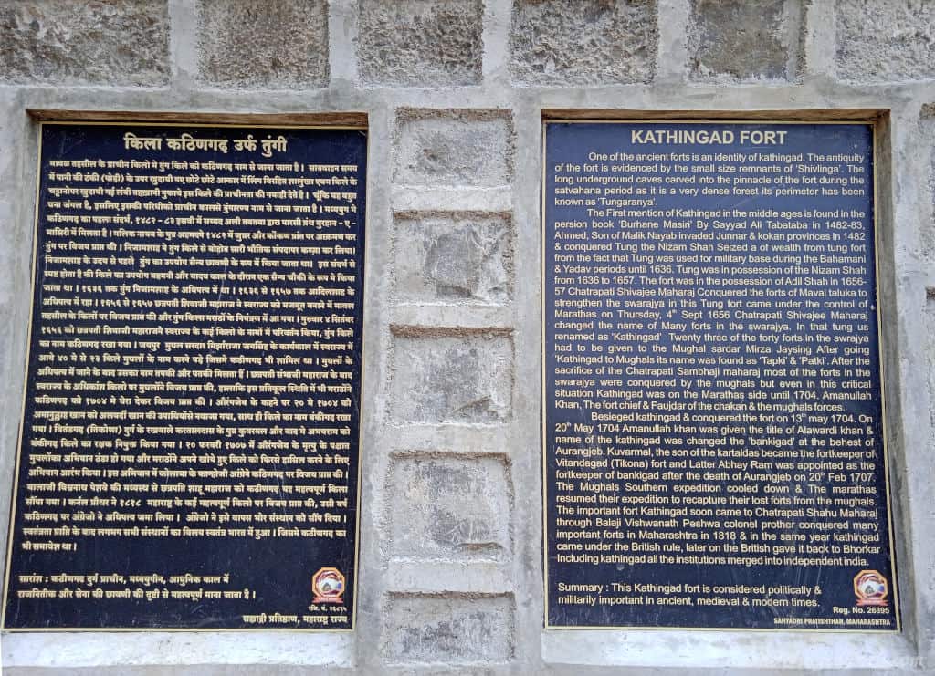
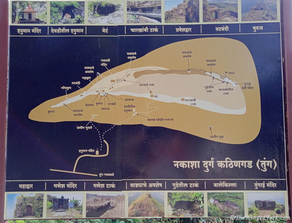
We started the hike at the bottom of the mountain where you will find a paved car park with some information boards giving a brief explanation of Tung Fort’s history.
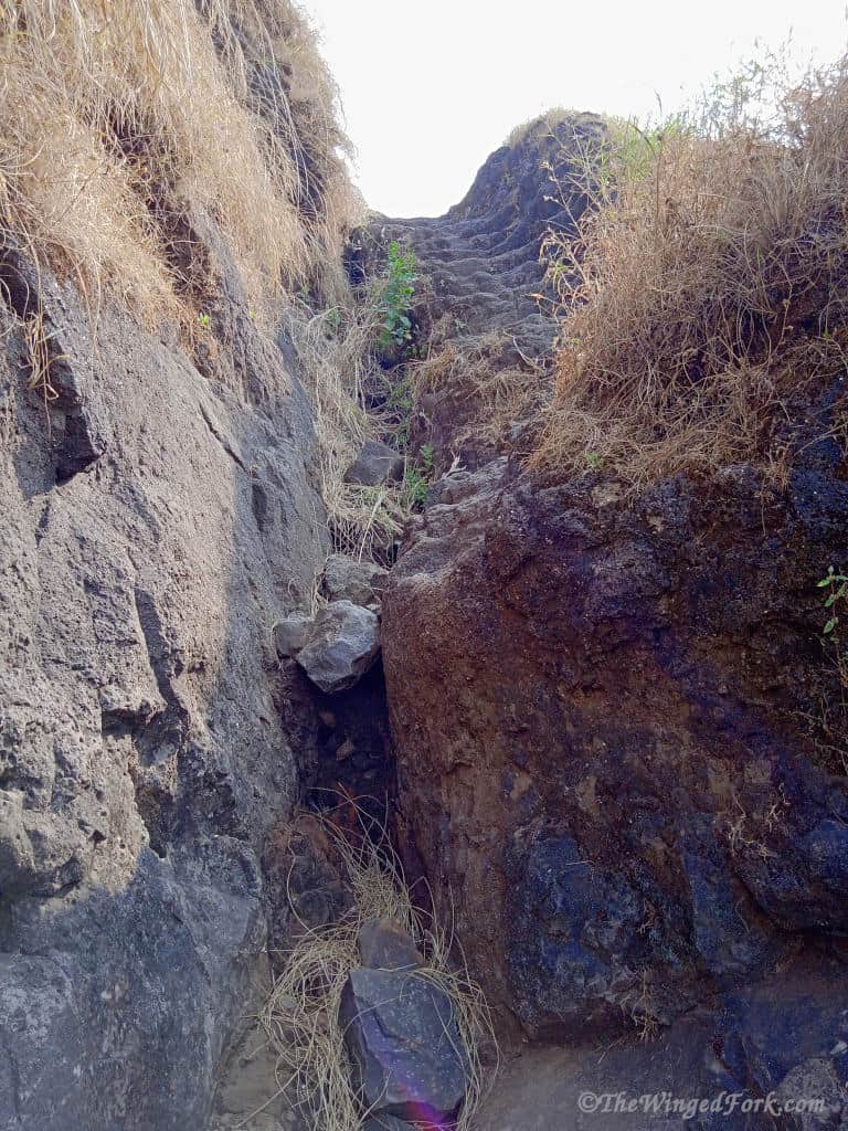
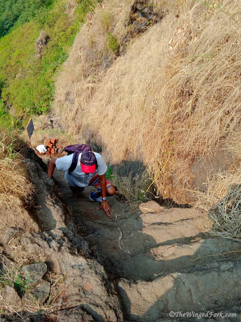
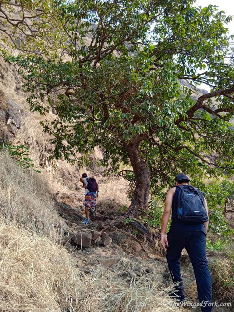
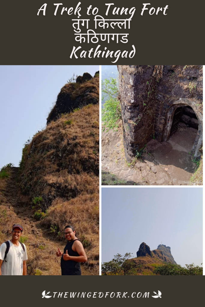
Follow the path up the mountain which in December is easy to see. The hike up to Tung Fort consists of multiple steep accents consisting of various sized steps cut out of rock followed by sections that are flatter and easier to hike. Caution is advised whilst undertaking this hike as parts of the path are narrow with steep drops next to it. Make sure you carry enough water in your daypack especially when hiking in summer.

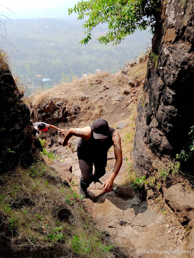
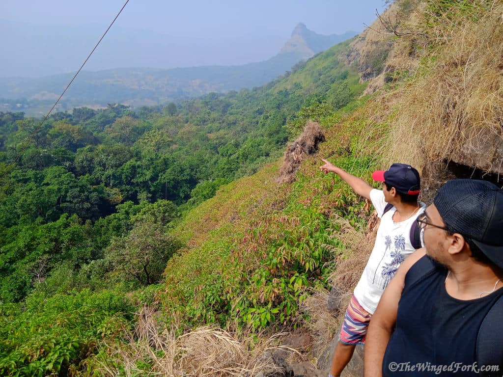
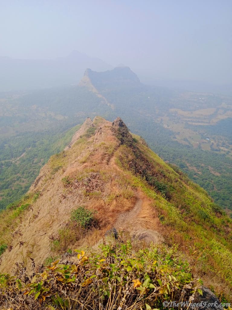
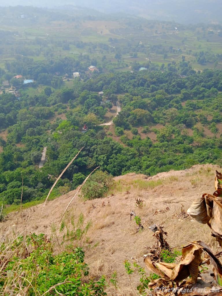
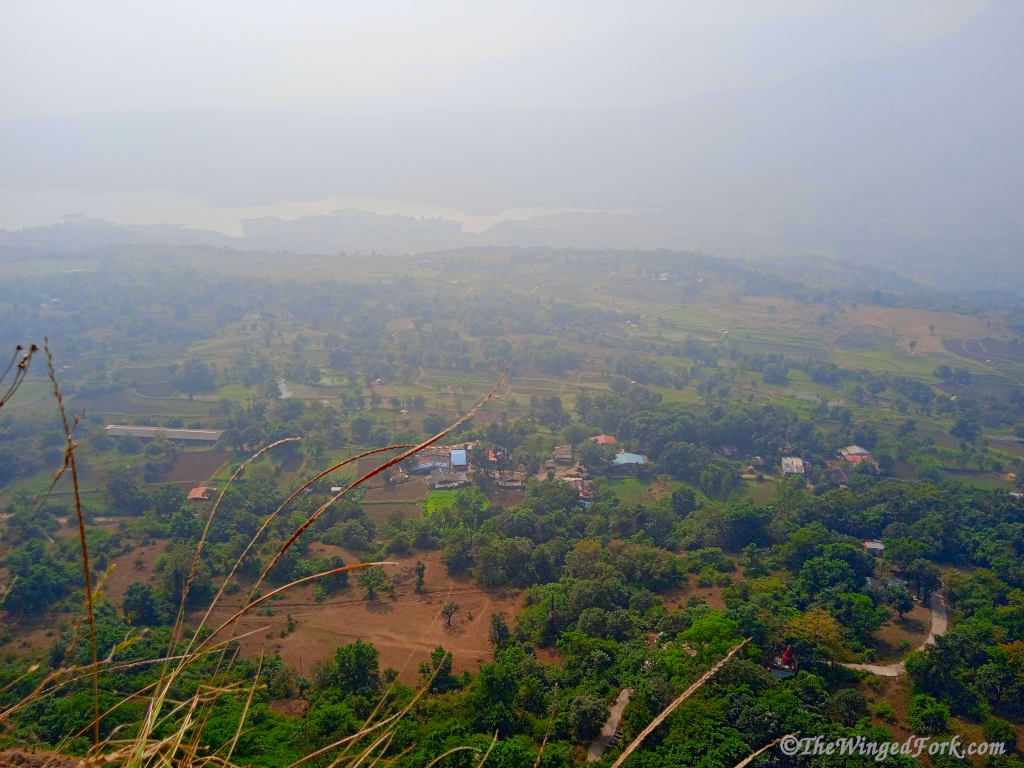
Due to the steep nature of the terrain, you ascend quickly and before you know it you are presented with beautiful views of the valley below and the southern section of Pawna Lake. The lush greenery reminded me of the Blue Mountains at Katoomba.
The day we went was misty which meant that our views were restricted but it also meant that the sun was not that strong. There are a few bigger trees along the first half of the ascent to take a rest stop and cool down in the shade.
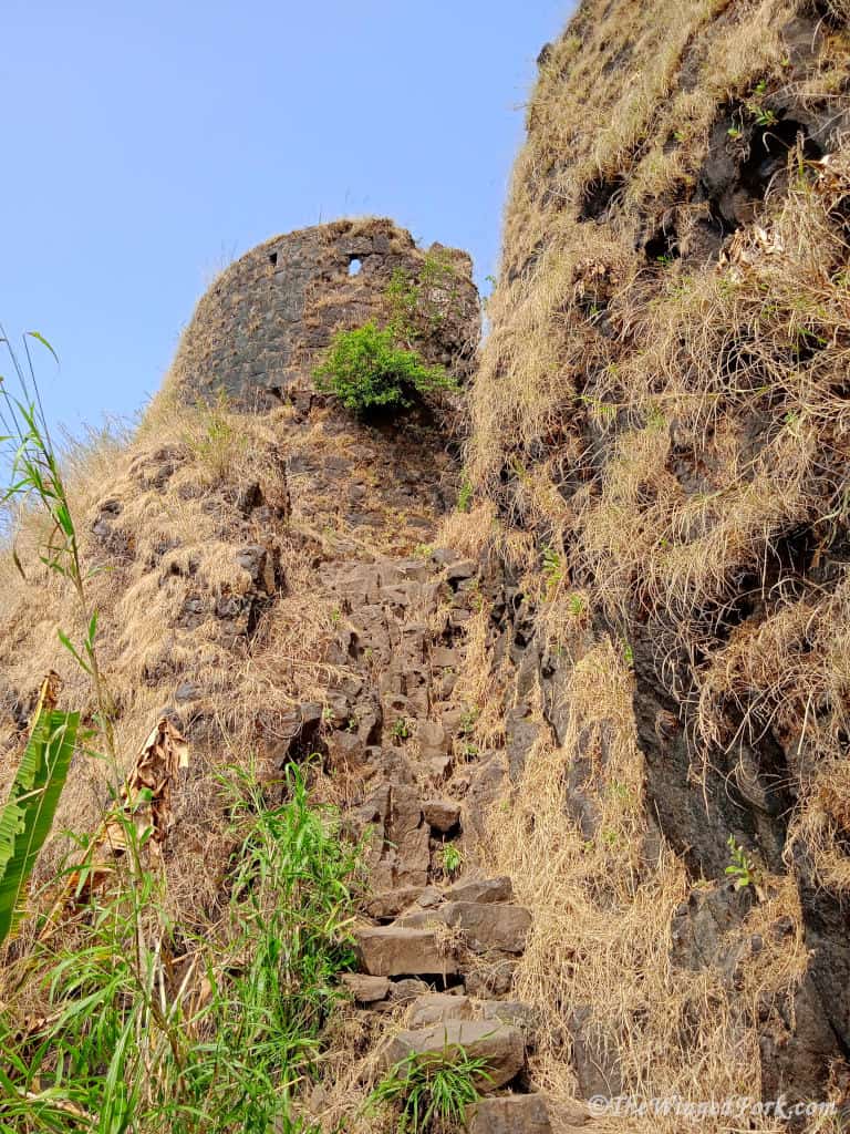
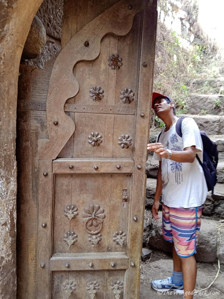
Just before you reach the top, the lower section of the fort you will enter through two gateways. Both are still intact, built out of stone. The second one with beautiful wooden doors which are still operational.
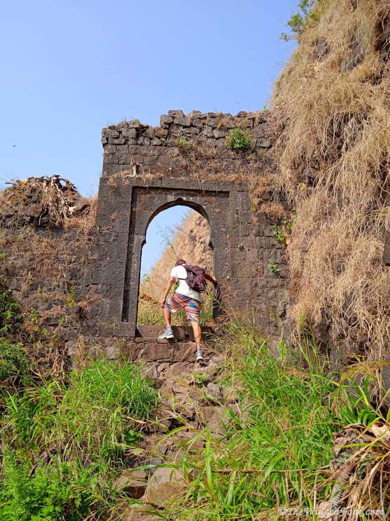
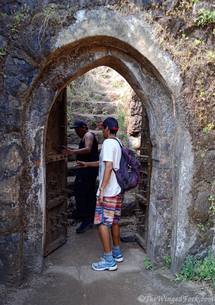
Once through the wooden doors and up the steps the hill plateaus out.
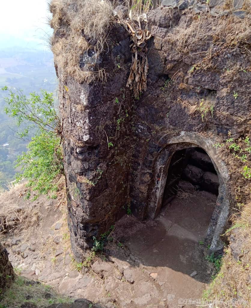
Here you will find the water reservoir that still holds water and a building next to it.
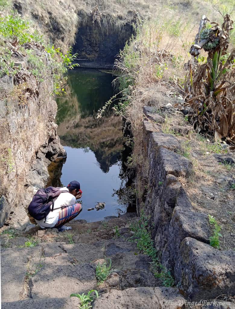
Other than these man-made structures we did not come across any other signs of fortification in this section. With that said we did not venture to the westernmost part of the mountain which according to the information board should have a few more man-made structures to show part of the original fortification.
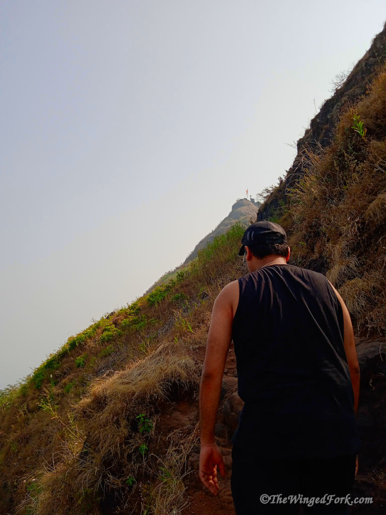
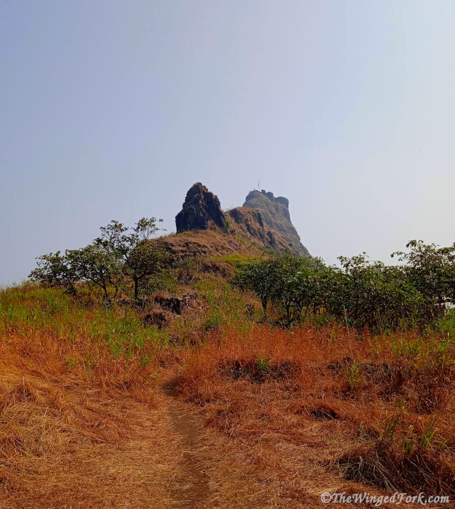
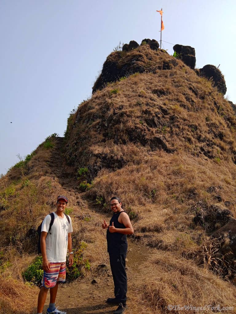
The hike to the summit of Tung Fort is another 10 minutes from here where you will find the झंडा – flag.
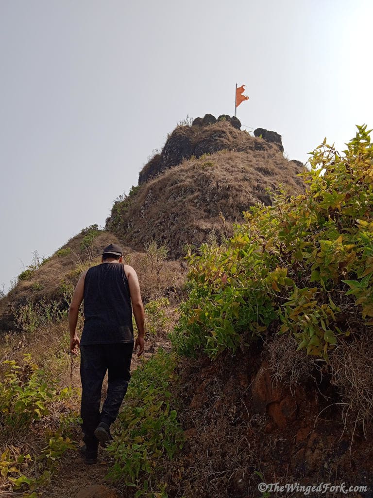
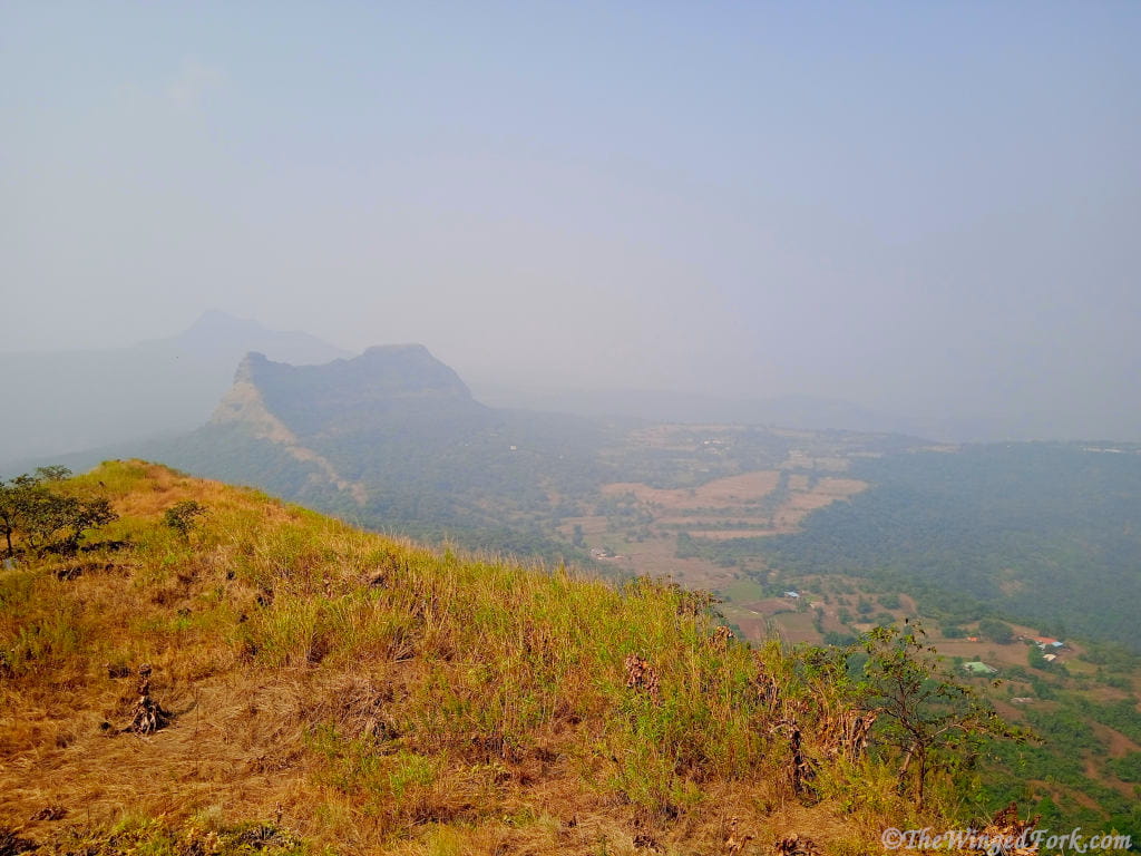
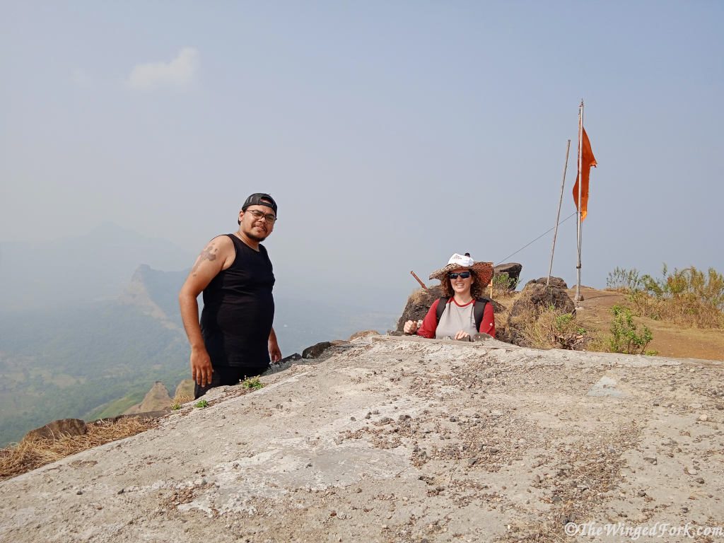
On the summit, you will be able to see all of Pawna Lake and the surrounding valleys and hills.
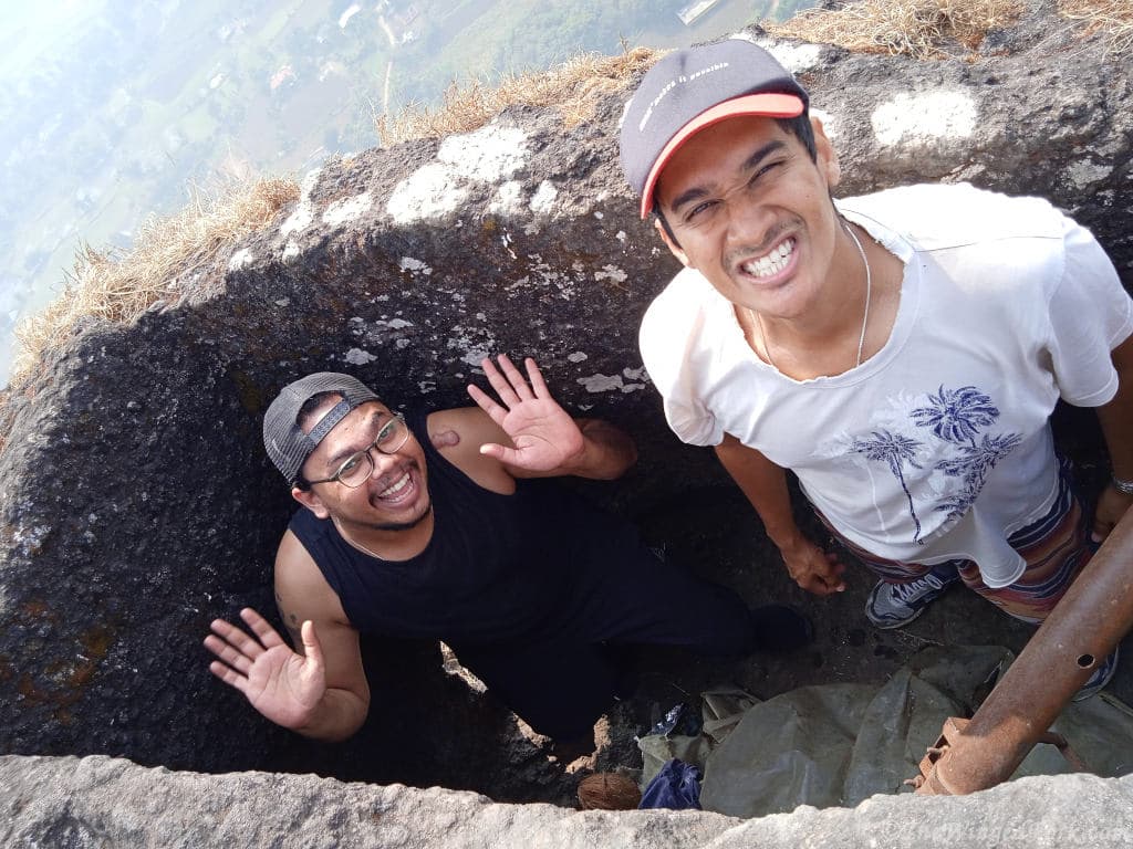
We had a minor Tung Fort accident here when one of our hiking party descended into a cavern cut out of the rock and scraped his elbow. Luckily no first aid was required.
I highly recommend this trek for a lovely day out. We were very fortunate when we went as there were only 3 other people that we met at the top. So if possible plan the trip during off-peak times to avoid overcrowding.
Brief Tung Fort History
The Fort is believed to have been constructed around 1650CE by the Adil Shahi dynasty. Due to the size of the fort, it was most likely used as a type of watchtower to possibly alert the larger nearby forts, namely Visapur Fort and Lohagad Forts, of imminent attacks.
Tung Fort is situated at an altitude of 1075m and is now surrounded on three sides by the Pawna Dam that was created by the Pawana Dam project in 1973.
How to reach Tung Fort in Maharastra
Travel time from Mumbai will be roughly 4 hours taking the Mumbai Pune Highway.
Travel from Pune takes 2hr 30mins and it is highly recommended to go onto the Mumbai/Pune expressway till Lonavala. The other road via Mulshi Road which is 25km shorter has many sections of unpaved roads as of December 2021.
Travel time from Lonavala is 1hr via Jalvaayu Marg (SH110).
From all 3 origins mentioned above: Once outside Lonavala follow Jalvaayu Marg (SH110) through the mountains then get onto Lonavala Aamby Valley Road. Turn left onto Javan Tungi Road to the Carpark at the base of the Mountain next to Hanuman mandir and enjoy an easy hike up to the ‘Difficult Fort’ aka Kathingad.
Old monuments like these are physical expressions of the culture of a people – explore more on our culture page.
Other Posts About India You Might Like
- Nahargarh Fort – Abode of Tigers
- Lohagad Fort in Maharashtra
- Exploring Castillon de Montjuich
- Why buy gold and things
- Peru’s amazing Machu Picchu


South African born and British bred, The Soz often takes to the skies. However the majority of the time these gravity-defying feats are for business and not pleasure. The Soz loves spending time in the kitchen cooking traditional South African dishes and English food!
Thank you. Just wanna say thanks. What an Article! Everything so clear and in so much detail. Top quality photography Feeling myself on the hike. Got a bit of history also. Thanks again Sir.